
Tropical Storm Humberto Forecast and Strengthening Trends
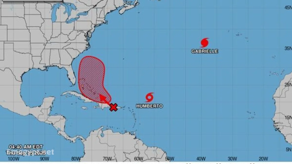
According to the National Hurricane Center, Humberto is steadily intensifying over the warm waters of the Atlantic. Sustained winds are approaching hurricane force, with projections indicating that Humberto could strengthen into a major hurricane within the coming days.
The storm’s current track keeps it over open water, but its wide cone of uncertainty highlights the potential for future shifts. Coastal areas in the Southeast United States are advised to monitor for impacts such as high surf and rip currents, even if Humberto remains offshore.
Key details from the forecast:
| Factor | Current Status | Forecast Trend |
|---|---|---|
| Wind Speeds | Near hurricane strength | Likely to reach major hurricane |
| Location | East of the Leeward Islands | Moving northwestward |
| U.S. Impact Risk | Low direct landfall risk | High surf and rip current threat |
Spaghetti Models Show Diverging Paths for Humberto
Meteorologists are closely analyzing the latest spaghetti models, which display a wide range of possible tracks for Humberto. While some ensemble members keep the storm far out in the Atlantic, others curve it closer to the Eastern Seaboard.
The diverging scenarios underscore the uncertainty that often accompanies longrange forecasts. As the system strengthens, the models will gain more clarity, but at present, forecasters stress vigilance for East Coast residents.
Hurricane Imelda Outlook and Development of Invest 94L
While Humberto dominates headlines, attention is also fixed on Invest 94L, which has a high probability of developing into Hurricane Imelda. Current forecasts show the system organizing near the Bahamas with conditions favorable for intensification.
Spaghetti models for this storm show wide variability, with some runs suggesting a track toward the Southeast United States, while others curve it harmlessly out to sea. The National Hurricane Center indicates an 80 percent chance of formation within 48 hours and 90 percent within the next week.
Current highlights of Imelda’s outlook:
-
Heavy rainfall is already affecting Hispaniola, the Bahamas, and parts of Cuba.
-
Tropical storm development could occur as early as this weekend.
-
U.S. coastal impacts remain uncertain but cannot be ruled out.
Fujiwhara Effect Forecast and Possible Storm Interaction
One of the most dramatic possibilities raised by forecasters is the Fujiwhara effect forecast. This phenomenon occurs when two cyclones come within close proximity, causing them to rotate around a shared center.
In this case, some models indicate that Humberto and Imelda could move close enough for interaction. If that happens, their tracks could shift dramatically, with one storm potentially absorbing or deflecting the other. While the Fujiwhara effect remains speculative at this stage, it represents one of the most unusual scenarios of the season.
NHC Tropical Outlook and Preparedness
The NHC tropical outlook emphasizes the importance of continuous monitoring, especially for communities along the Southeast coast. Even if neither Humberto nor Imelda makes direct landfall, secondary impacts such as rip currents, high surf, and flooding rains remain significant threats.
Preparedness recommendations include:
-
Review hurricane safety plans now.
-
Stay updated with NHC advisories issued every 612 hours.
-
Watch for rapid intensification alerts.
-
Monitor local emergency management updates for evacuation guidance.
By issuing this comprehensive tropical outlook, the National Hurricane Center aims to ensure that communities remain informed and ready as the peak of hurricane season unfolds.